[Attention: If you didn't request this email you can click here
to stop them.]
|
|
I made a quick jaunt up to Seattle over the weekend for family fun time. There was a lot of traffic, but no map needed. Maps! That’s my smooooth transition to what’s new at FreePrintable.net this week. I’ve added 60 new printable maps to PrintableWorldMap.net. You’ll find maps for travel, for
learning geography, and for stargazing. Plus, I’ve added decorative maps.
It’s been about five months since I set up the FreePrintable.net Patreon page, and I can’t tell you how much I appreciate those of you who have become members via a monthly donation.
Your support means that I can create even more free printable goodness than ever before. Thanks, too, for sending me your ideas for new printables. | |
|
|
The newest printable maps at PrintableWorldMap.net cover all kinds of geographic needs, from education to decoration. There are now more than 200 maps to instantly download and print for free.
The collection of constellation maps continues to expand. Just-added are: Aquila, Andromeda, Bootes, and several more.
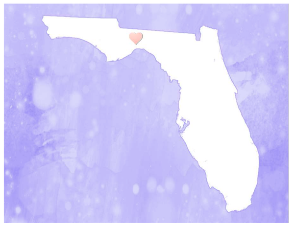
A new set of printables at PrintableWorldMap.net is 50 cute state maps. Yes, cute maps! These are watercolor-look maps with a heart in the general vicinity of each state’s capital. Print out a map of your state, or one you’d like to visit, and frame it! There are decorative maps of all 50 states, in watercolor purple, pink, blue, green, orange, yellow, and red.
PrintableWorldMap.net is especially handy for teachers, as there are both blank and labeled maps, plus versions with lines on which to fill in the names countries or states. (Also, be sure to check out TeachersPrintables.net for classroom printables and PrintablePaper.net for all kinds of papers.)
The topical maps at the site are full-color and include: time zones, state flags, bodies of water, the Roman empire, the Oregon trail, wildlife habitat, major U.S. cities, and more. There are 60 new maps in all.
You can download and print any map at the site free. Some are available in both landscape and vertical orientations. They’re easy-to-open PDF files. Or, there’s the convenient option to purchase the entire map collection in one
download for just $9.
Thanks for emailing me your ideas for new printables! As you can see, I’m adding new stuff all the time. Please check out the FreePrintable.net Patreon page and consider becoming a member. Thanks and happy
printing!
|
|
|
|
|
Sincerely,
FreePrintable.net
kevin@freeprintable.net
|
|
|
|