Hello! You are receiving
this weekly newsletter because you subscribed from
on . If you don't want to receive it anymore, just click this link
and I'll unsubscribe you right away. |
|
I’m still shaking off the snow from a fun-filled family trip to the Oregon mountains near the town of Bend. Our 8-year-old
built a snowman (yes, we sang the song from Frozen) and bested my wife and me in a snowball fight. Our Dalmatian, Louie, would not stop digging in the snow. Crazy pup. Meanwhile, some of my friends back in California were experiencing 80-degree weather. I prefer cooler weather, so I guess I’m definitely an Oregonian now.
Plus, I’ve added new borders to PageBorders.net for St. Patrick’s Day (coming up March 17) and Easter (April 5).
| |
|
|
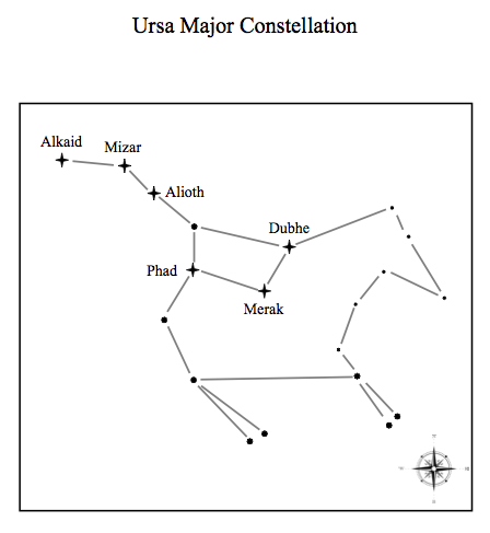
At PrintableWorldMap.net, you’ll find more than 165 world maps to download and print for free. I’ve just added 45 new maps, including several U.S. region maps (such as New England and the Northwest) and maps indicating historic sites and travels (the Oregon Trail and Route 66). There’s an entire new category of constellation maps featuring 23 different star formations, such as Orion and Ursa Major as well as all the signs of the Zodiac.
Other new maps include: a “cute” colorful map of the United States, a longitude and latitude map, a map
of the hemispheres, U.S. Zip codes, and the National Parks. You’ll also find historic maps of ancient Egypt and Greece and a map of Earth’s major bodies of water.
The site has blank maps (for students to fill in) as well as labeled maps.
There are continents, countries, states, and regions represented, all in easy-to-print PDF form. Some are available in both landscape and portrait orientation.
All of the maps at PrintableWorldMap.net are free to download and print
individually. If you’d like the convenience of having all 165-plus maps in one download file you can save to your computer (a great option for educators or stargazers), the maps collection is just $9.
|
|
Sticking with the world theme, I also have several dozen new printable flags up (raised?) at FreePrintableFlags.com. They complement the existing collection of flags so there are now 131 from which to choose.
FreePrintableFlags.com has flags from all continents as well as the Caribbean, Oceania, Atlantic islands and territories, and the Pacific islands. All of the flags are rendered in full, accurate color, in sufficient resolution to print nearly as large as a sheet of letter-sized paper. There are four variations of each flag, including the ability to have the name of the nation printed beneath the flag, or not. The flags are also available in outline form, to color in with crayon or markers.
The newest round of additions include many flags of Europe as well as the nations of: Afghanistan, Barbados, Bangladesh, Belize, Ecuador, Ghana, Honduras, Indonesia, Montserrat, Puerto Rico, Qatar, Singapore, Somalia, Thailand, Uganda, Uruguay, and, last but not least, Zambia and Zimbabwe. I’ve added 60
flags in all this week.
The flags download in PDF format and, again, all of them are free. Please keep sending me your ideas for new stuff! I’ve come in from the cold and am hard at work on new printables. Happy printing!
|
|
|
|
|
Sincerely,
FreePrintable.net
kevin@freeprintable.net
|
|
|
|